AQL PropertyCheck
GOLD COAST
EXACT-ADDRESS PROPERTY CHECK

The home looks perfect. But what’s it really like to live there?

Check one address before you rent or buy. Go beyond the listing: see the building and neighbouring sites, the street at its door, parking context and everyday journeys where the data supports them. Flood and planning checks are included too.

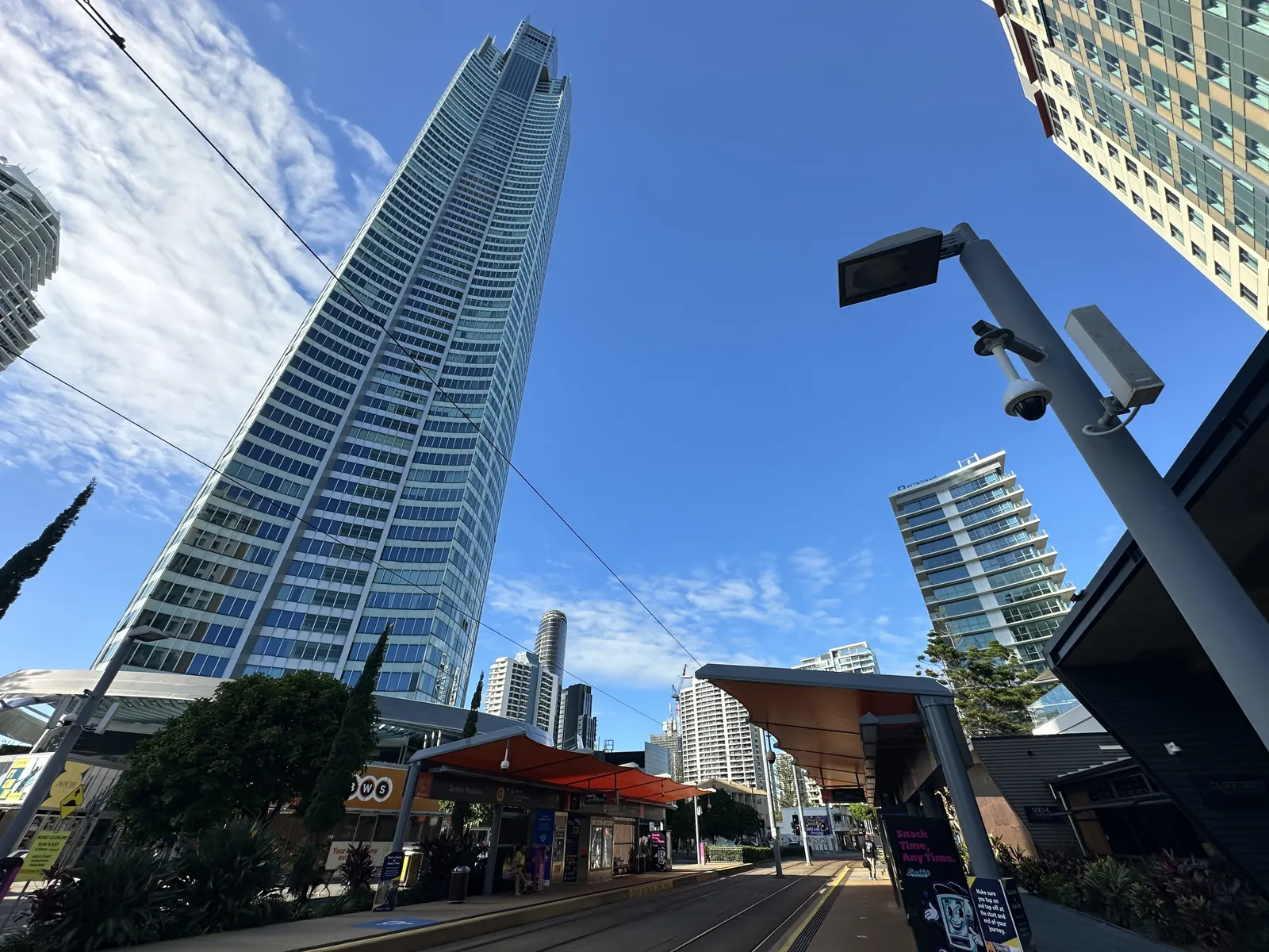
The Q1 tower at 9 Hamilton Avenue, seen from the street at Surfers Paradise light rail station Sample: 9 Hamilton Avenue, Surfers Paradise Q1 from the light rail station · Photo: Totallynotarandomalt69 / Wikimedia Commons, CC BY 4.0, cropped
Saved sample, not a live lookup: 9 Hamilton Avenue, Surfers Paradise (the Q1 tower), seen from the light rail station. A live Q1 search may need a registered unit number to identify the right building; the report does not analyse that apartment. Photo: Totallynotarandomalt69 / Wikimedia Commons, CC BY 4.0, cropped (Jun 2026).
Tap a result to see what was found and where it comes from.

What could the listing be missing?

Photos show the rooms. These are the questions they leave open. Explore a real Gold Coast report example.

A listing photo can make a street look quiet. At this sample address, three nearby roads have recorded traffic volumes of about 4,200–5,200 vehicles a day.

01

Your Property & Neighbours

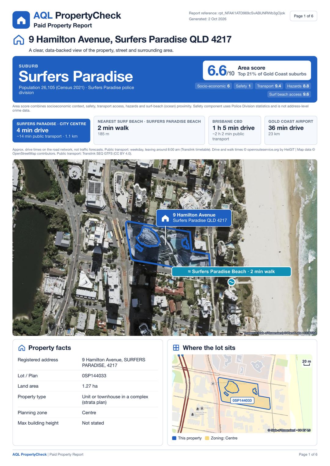
See the lot, whole-building size and gap to separate neighbours where these can be measured — not a particular unit's view.

Aerial view of the lot at 9 Hamilton Avenue© State of Qld; © Planet Labs
02

Roads, Parking & Access

Check published street width, kerb parking rules, nearby counted traffic and transport stops where data is available.

Street photo beside 9 Hamilton Avenuevagrant42 / Mapillary · CC BY-SA 4.0
03

Everyday Life

Check nearby beaches, schools, shops and parks; walking routes appear where they can be calculated.

Aerial view of Surfers Paradise Beach next to the sample address© State of Qld; © Planet Labs
04

Hidden Issues

Whether the lot sits in a mapped flood, bushfire or transport-noise area, and the planning zone around it.

Flood, bushfire, transport noise and other hazards: the four hazard pictures of the sample reportSample report, page 4

Real data. Real sources. No guesswork.

If a fact can’t be verified, we tell you.

Official and licensed data, with sources and dates where supplied by the result. How we check an address

Local
councils
Queensland
Government
Transport and
Main Roads, Translink
Licensed
data
SAMPLE REPORT

See a real PropertyCheck report.

Explore a sample report and see the kind of information you’ll get, with sources and reference periods where available.

View sample report
Free preview
  • Address and lot match, land area and planning zone where published
  • Mapped flood, bushfire and noise overlays where available
  • Nearby counted-road traffic where published
  • School catchments and nearby transport where available
  • Police-division safety context, not a home-level crime score
Full PDF report · A$17.95
  • A report to keep, with sources and data dates where supplied
  • Whole-building footprint, open area and neighbour gap where measurable — not a unit view
  • Kerb parking rules and road-access context where published
  • Traffic on counted roads nearby
  • Crime trends with the geographic limits explained
  • Walking and journey times where routes can be calculated
  • Building height, year and storeys only where verified